

What you need
An Android phone with GPS and the free Car Compass app. There is no account to create and the app works without internet. Your location is only read while the app is open.
Step by step
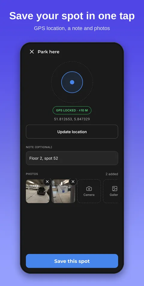
- Park and tap Park here. The app reads your GPS and saves the spot. The label under the ring shows how accurate the spot is. If the signal is weak, the app suggests walking away from buildings or waiting a moment. Saving always works.
- Add a note and photos. Write down what you will want to know later: the level, the bay number, the colour of the pillar. A photo of the sign by the lift helps most. Photos stay on your phone.
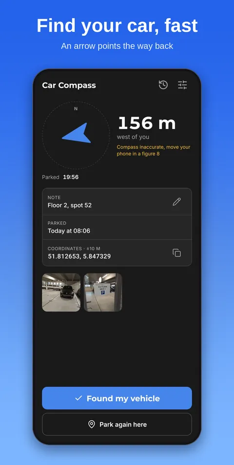
- Walk back and follow the arrow. Open the app when you return. A large arrow points at your car and the distance counts down as you walk, in metres and kilometres or in feet and miles. Within about 500 metres the screen stays on so you do not keep unlocking it. When you arrive, the app says you are there.
- Tap Found my vehicle. The spot moves to your history, where you can look at it later or delete it.
Saving faster
You do not even have to open the app. Put the widget on your home screen, or long-press the app icon and choose Park here. Both save your spot in one tap.
In a car park or with poor GPS
The arrow points in a straight line and gives no route. In a car park it will point straight through walls. Use it to reach the right level and the right corner, and let the note and photo do the last stretch.
GPS is often weak under a roof. The app keeps how accurate each spot was and turns that label orange when it may be well off. If the arrow seems to wander, move your phone in a figure 8 to calibrate the compass.
Sharing or opening in a maps app
Next to the coordinates you can copy them, share them (with a Google Maps link) or open the spot in your maps app. The coordinates only leave your phone when you tap one of those buttons.